

APPLICATIONS
TOPKAPI has been applied all over the world for more than 10 years in both small and large catchments including mountainous areas, sub-tropical climate areas and dry regions, and it has been found to be a robust and powerful tool.
A short list of catchments that have been modelled using TOPKAPI include Po, Adda, Adige, Arno, Serchio, Tevere and Reno in Italy, Miño, Duero, Tajo, Jucar and Segura in Spain, Haute Glacier d'Arolla, Rhone Glacier and Chiene in Switzerland, Yellow River (Huang He), Fuchun (Qiantang) and Buliu River in China, Mekong in Vietnam, Upper Aconcagua in Chile, Liebenbergsvlei in South Africa, American River and Carson River in the USA, and many more.
Some of our customers:
| National | International |
|
|
TOPKAPI MODELLING SUITE
TOPKAPI modeling suite offers a complete suite of programs to provide easy, GIS based solution to hydrological modeling problems.
The modelling suite allows Users to perform main tasks of hydrological modelling:
- geo-processing grids and shapefile,
- building the model using geo-referenced maps and information,
- manage parameters,
- run simulations,
- analyze results.
TOPKAPI modelling suite is based on a free and open source GIS thus avoiding additional licensing costs.
| PreTPK | I.TOPKAPI | TPKVIEW | TPKMAPS |
|
|
|
|
|
|
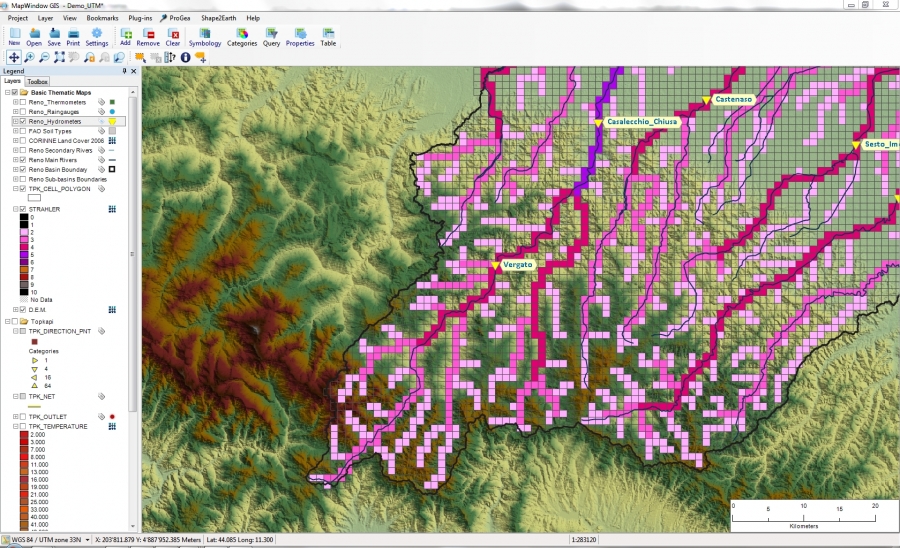
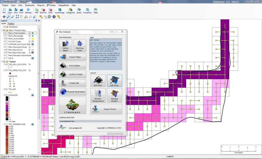
GIS-based visual interface for geo-processing and model set up.
|
Visual interface for managing model's parameters and simulations.
|
Visual interface for results analysis (time series). | Visual interface for state maps analysis. |

ALL-IN-ONE HYDROLOGICAL MODELLING
- GIS Tools
- Support for the most industry standard hydraulic models (soon available)
- Automatically delineate a watershed and sub-basins using digital terrain data (through third party software)
- Add any number of interior outlet points
- Manipulate stream network and DEM using GIS tools
- Manage parameters and display results inside GIS interface
IMPORT THE DATA YOU NEED AND CREATE YOUR MODEL
- Web-based data acquisition tools (through third party software)
- Export to GoogleTM Earth (through third party software)
- Read ESRI ASCII GRID maps and ESRI shape file
- Read TIFF, JPEG image files – images along with geo-referencing information